Choose the bayou, bay, sound or river setting closest to your property. Each guide explains the local records and questions that matter.
Your waterfront, in context
Explore the coast. Find your starting point.
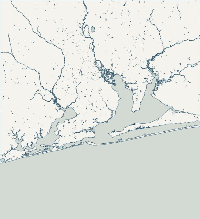
Follow the shoreline from Perdido Bay to Navarre, or explore the bayous and river communities. Each guide explains the local conditions and where to start.
Full local guide
Choose a label to open local resources →Tap a community on the map or below ↗
East Hill and East Pensacola Heights share Bayou Texar, but a wall on one shore can meet a different drainage outlet or street edge from a wall opposite it. The city publishes a Bayou Texar Shoreline Protection District layer and a separate map of proposed stormwater outfall improvements. Start with the address and the nearest mapped outfall, then establish which structures belong to the property.
Scenic Highway frontage needs a view of the slope as well as the waterline. The red-clay bluffs overlooking Escambia Bay are a documented local feature, and the city maps an Escambia Bay Shoreline Protection District. Bay Bluffs Park is a useful local reminder that boardwalks, slopes and shoreline access can require separate structural and geotechnical investigation.
Downtown and Sanders Beach frontage sits beside public waterfront investments with their own boundaries and records. Bruce Beach forms part of the continuous waterfront-trail vision, while Sanders Beach Park has a separate improvement program. Before planning a private wall, distinguish the parcel edge from public park, street and waterfront infrastructure.
Bayou Chico has a working-waterfront history and a sediment-remediation program that make excavation questions especially important. EPA has documented legacy contaminants in bayou sediments, and Escambia County has investigated soft-sediment distribution and habitat condition. Those regional records are a reason to investigate carefully, not a diagnosis of every waterfront property.
Bayou Grande brings together residential walls, canals, public park shorelines and living-shoreline projects. Escambia County documents erosion at Navy Point Park, while its Bayou Grande Villas drainage reporting describes a canal receiving runoff from Gulf Beach Highway. A useful assessment distinguishes waves at the shore from water arriving behind the wall.
Innerarity Point frontage can face Old River or the wider Perdido Bay setting. The federal record for Innerarity Point Park places Old River between the point and Perdido Key, with Galvez Landing beside the park. Identify the actual waterbody and the route equipment would take; a Pensacola mailing address does not describe those site conditions.
Perdido Key has lagoon-facing, channel-facing and Gulf-facing shorelines. Those settings should not share one generic wall proposal. Nearby Big Lagoon State Park includes tidal marsh and pine flatwoods, while the island has a specific beach-mouse habitat permitting program. Begin by locating the shoreline and the proposed disturbance on the same site plan.
Pensacola Beach is administered by Santa Rosa Island Authority in Escambia County. Its leasehold structure adds an approval step that mainland owners may not expect. A soundside wall, canal edge and Gulf-front dune project also need different site information. Bring the leasehold details and the survey to the first discussion, before selecting a repair product.
An address using Gulf Breeze is not enough to establish city jurisdiction. Inside the incorporated city, Community Services publishes a marine-construction application and the city FAQ also identifies a county building-permit role. Use the city maps to check the parcel first, then coordinate both local reviews with the environmental scope.
The soundside communities east of Gulf Breeze need their own access and drainage questions. Oriole Beach is represented in the water-quality record by a Santa Rosa Sound seagrass station, and the county’s ramp improvement project combines shoreline stabilization with stormwater work. Confirm the parcel’s municipality and waterway before treating a Gulf Breeze postal address as city jurisdiction.
Navarre and Holley include soundside and river-access settings that need different descriptions in a repair request. County records place Navarre Park beside Santa Rosa Sound, East River Boat Ramp on Highway 87 in Holley and another ramp on Live Oak Street. State the actual waterway and frontage rather than asking for a generic Navarre wall price.
Navarre Beach needs a more specific starting point than “replace the seawall.” Santa Rosa County identifies a separate island planning area with leasehold and zoning provisions. Its code also addresses coastal armoring and its application packet includes canal-specific structure limits. Determine whether the property faces a canal, the Sound or the Gulf before choosing a design.
Floridatown is a useful starting point for understanding Pace waterfront work on Escambia Bay. The county identifies the park on the bay’s eastern shore and describes its ramp as shallow-water access. It also documents major Hurricane Sally damage and a later dock reconstruction. Access, drainage and storm exposure deserve separate questions in a private repair scope.
Milton and Bagdad share a riverfront setting but should not be treated as one permit jurisdiction. Milton’s Riverwalk sits in its downtown historic district on the Blackwater River. Bagdad has a county-managed restored mill-site park and a separate historic-zoning layer in Santa Rosa GoMaps. Establish the parcel boundary and local authority before choosing an application.
Garcon Point is a peninsula with several bay exposures and important wetland areas. FWC places its wildlife management area between Escambia and Blackwater bays; the wider peninsula also borders Pensacola and East bays in the water-management district’s planning map. Name the actual shore and check the parcel rather than treating the peninsula as one uniform construction setting.